On a sunny Monday morning in the middle of May, we set out from our home in Oregon’s Willamette Valley. As we would do on most mornings during our road trip through the American West, we had flipped a coin to decide who would take the first driving stint. Each of us would drive about 100 miles at a time.
As we drive Highway 126 up to the Santiam Pass over the Oregon Cascades, I am imagining how I felt the first time we drove this stretch of highway. By now, we have done it so many times that we are no longer amazed by how beautiful it is, the tall firs lining the sides of the road creating a tunnel of trees. The beauty here is our extended home; the adventure would begin on the other side of the mountains. East of the cascades, the trees start to disappear and the view of the horizon opens up. All of a sudden the sky seems so much bigger.
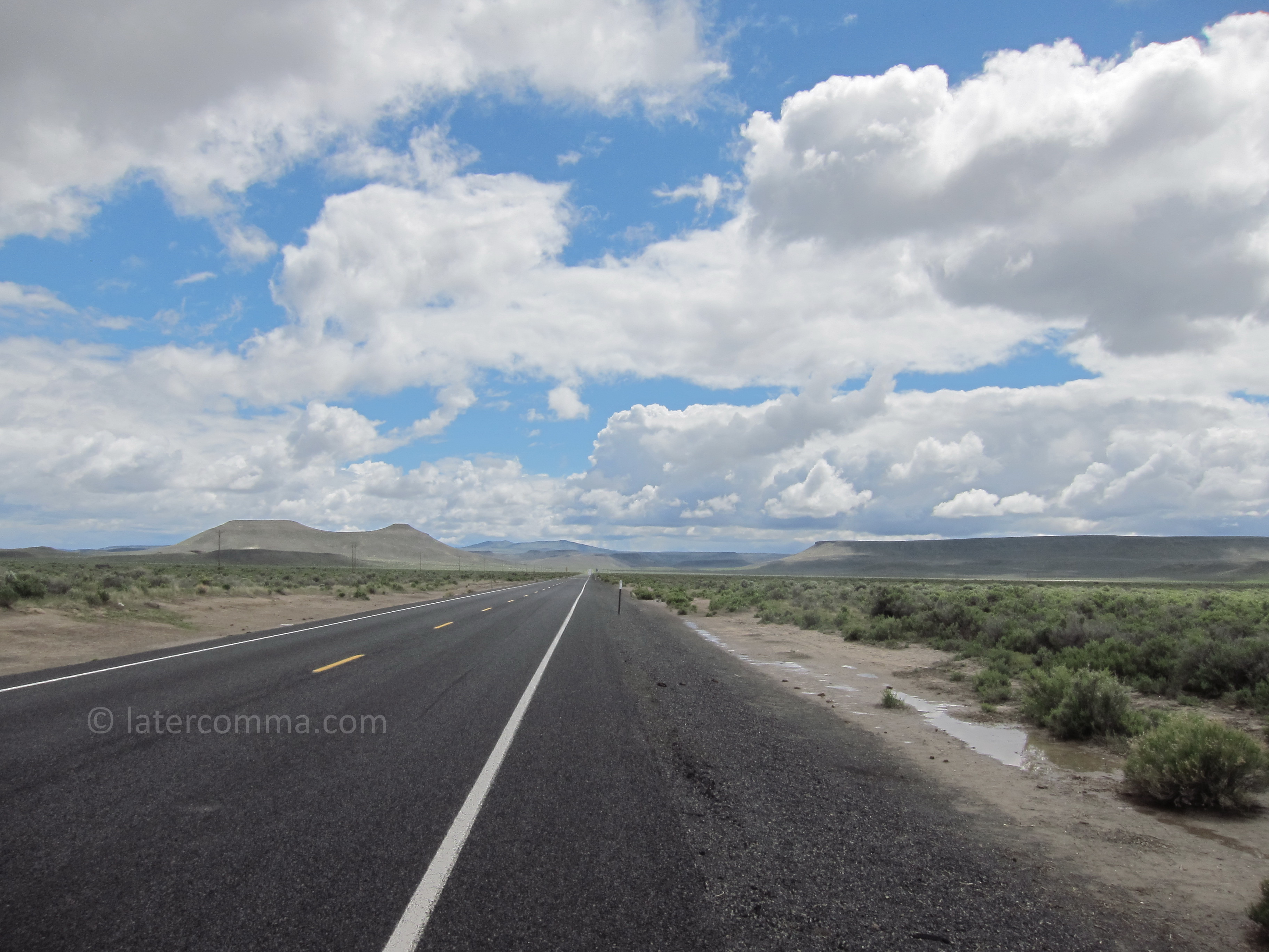
We cross the state eastward on Highway 20. It is high desert country, but this time of year there are shades of green in the grasslands and the wildflowers are in bloom. We had planned our route so that we would drive about 400 miles each day, and our destination today is Frenchglen. This small community lies at the southern boundary of the Malheur National Wildlife Refuge, a world-class sanctuary that attracts bird-watchers from all over (unfortunately, it also recently attracted a collection of armed wingnut pseudo-patriots who would not know a marsh wren from a warbler).
The sky around Frenchglen is amazing, with spats of rain and dark clouds, interspersed with brilliant sunshine. In the cloud-breaks, we can see the dramatic and beautiful Steens Mountain, an impressive snow-capped range at this time of year. The mountain road, a bumpy 18-mile gravel ride is still blocked with snow in late May, and we are advised to come back in September, when the weather is still nice and the mosquitoes are gone.
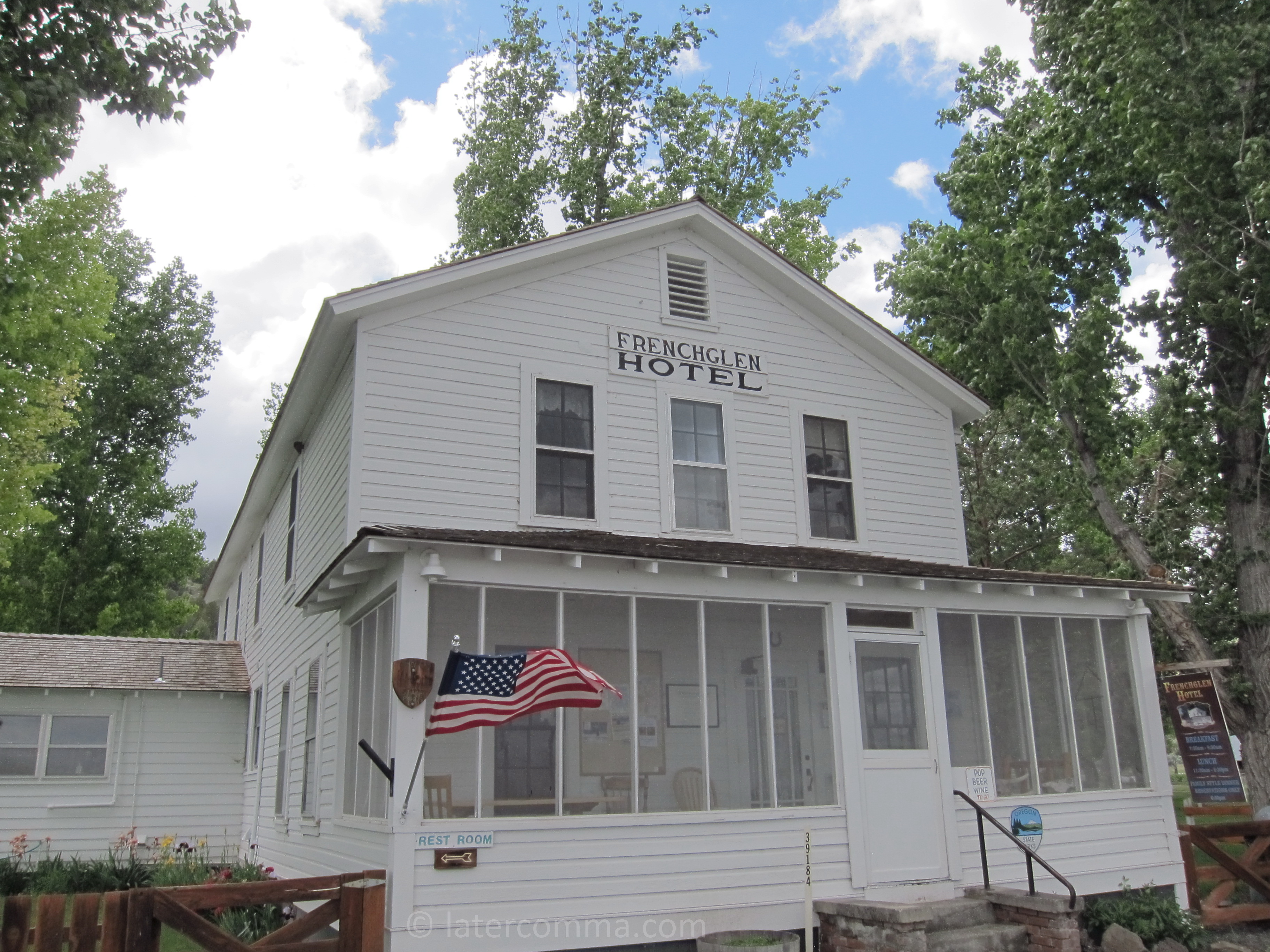
The Frenchglen Hotel
I like the idea of staying in older, historic places and participating in their history. We spend the night at the Frenchglen Hotel. The hotel was built in 1923 to provide rooms for guests who came to do business with the Swift & Company Meat Packers, owners of the P Ranch and most of the valley at one time. Our room is a bit of an experience, a tiny 10 by 9-foot cell with just about enough room for a bed. The men’s and women’s bathrooms are across the hall, shared with other hotel guests (the hotel operates a newer structure nearby, the Drovers’ Inn, which has rooms with private baths).
Among the 20 or so guests at the hotel with us, many are bird-watchers. Just nearby the hotel alone, we see many kinds of birds: owls, ravens, snipe, tanager, waxwing and sandhill crane.
Dinner is served family-style at the hotel. We sit at picnic tables in the lobby. Dinner is a fixed menu, but the usual selections are available for breakfast. On Tuesday morning, I have oatmeal with dried fruit. It is excellent and filling, possibly the best oatmeal I have ever eaten.
We leave Frenchglen, driving southwest on state Highway 202, a good road with dramatic vistas of cliffs that rise abruptly from broad valleys. We have a new appreciation for the land forms, thanks to one breakfast companion, a geologist, who described the basin and range geology that is typical of this part of the country. Much of the western US is characterized by these formations, which, he said, from the air resemble “caterpillars crawling to Canada.”
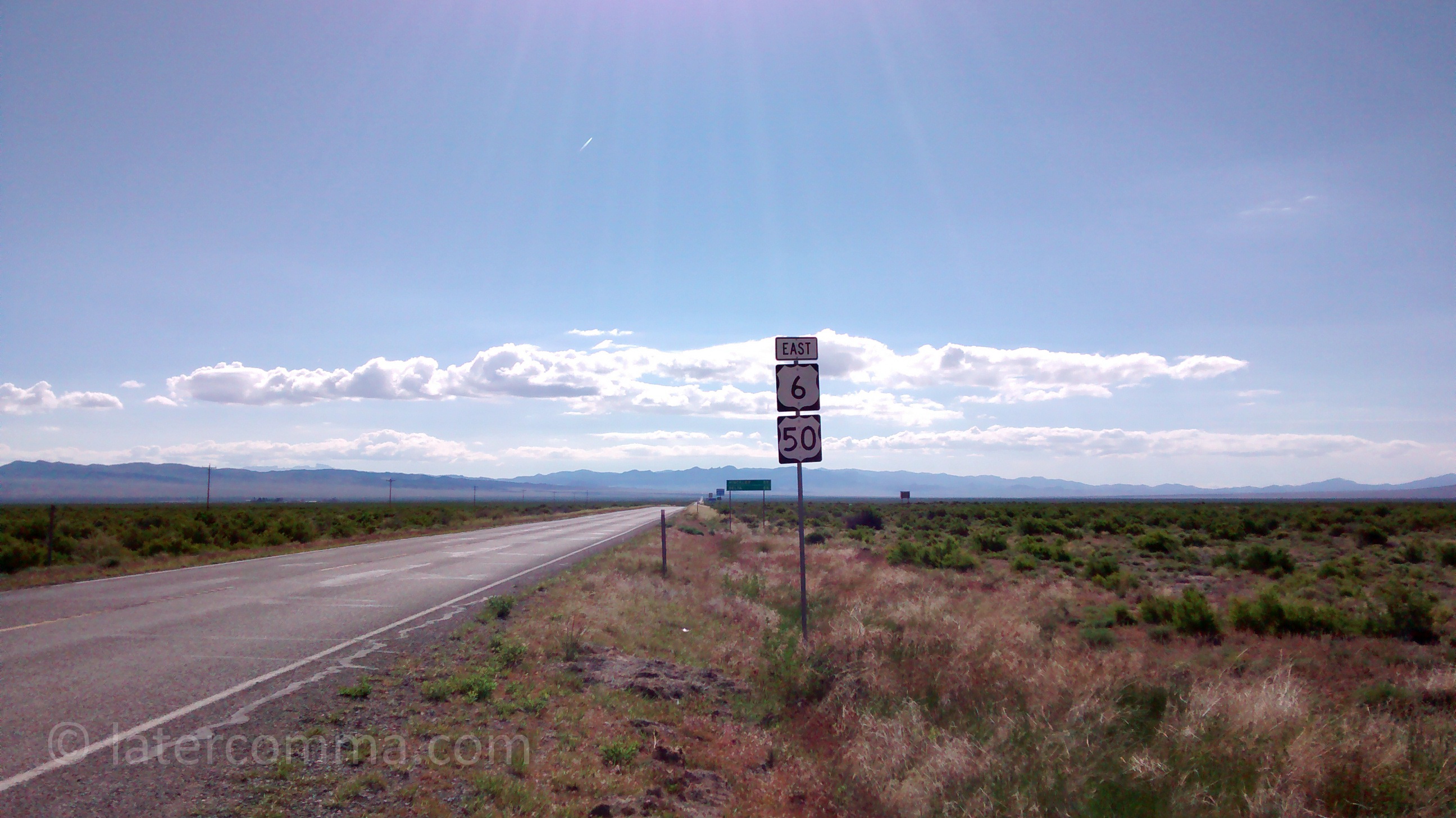
We cross into Nevada, and the road becomes Highway 140. We are heading southwest. Our destination is Ely, about 440 miles from Frenchglen. We join I-80 at Winnemucca and travel east on the interstate for about 100 miles.
Nevada On I-80
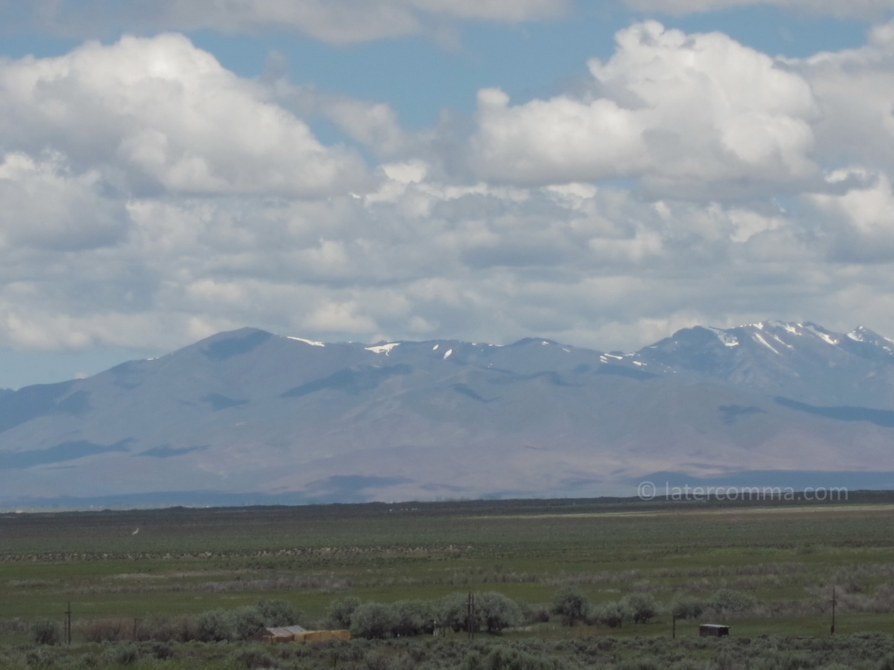
The landscape is a mosaic of many colors—my wife counts 20 different hues. It is difficult to capture in photos. We see lots of different kinds of wildflowers. Chipmunks dart across the road, little daredevils that, I think, run in front of oncoming cars for sport. This part of Nevada is surprisingly beautiful; the highway passes through rolling hills with snow-capped peaks in the far background. Big cumulus clouds fill the sky, dropping rain in some places, but the showers are short-lived and as soon as we drive out of them, the land is quickly dry. The trees are short here and the sparse vegetation clings to every drop of water.
We prefer to travel on state and federal highways that are off the interstate system, and we exit I-80 to take Highway 278 south at Carlin.
Looking back after our trip has ended, we think that The Sheep Incident occurred along Highway 278, but our memories are uncertain. I am driving and we are in the midst of a conversation about something. The speed limit is at least 70 on the two-lane road. All of a sudden, from my left, a sheep bounds onto the highway out of nowhere. He is less than 100 feet away when I see him, and I step on the brake, but I realize there is no way to stop the car before reaching the sheep’s location. The sheep stops in my lane and looks back at me. In a matter of seconds, I swerve into the left lane to avoid a collision. There is no oncoming traffic, and there are no other sheep along the road, just this one seemingly solitary wandering sheep. Our trip was saved from disaster by a cooperative maneuver between sheep and driver. The sheep could have reversed his course at the last moment, and I would have hit him in the left lane, but instead, he maintained his heading and ran off to the right side of the road.
At Eureka, we meet US 50. Before I-80 was built, US 50 was a major east-west route across the country from Sacramento to Ocean City, Maryland. Now that most through-travelers take the interstate, US 50 in Nevada has been dubbed “the loneliest road in America.” It is a great drive.
As we head into Ely, we read in the AAA Tour Book that the town, which started as a silver-mining camp in 1868, flourished with the arrival of the Nevada Northern Railway and the Kennecott Copper Corporation, whose Liberty Pit extracted more than $550 million in copper, gold and silver. From the highway, we see enormous piles of mine tailings, a mountain range unto themselves. Stark orange, red and yellow piles of rock spill off the hillsides forming unnatural cliffs of tailings with no vegetation to hold the unstable earth in place.
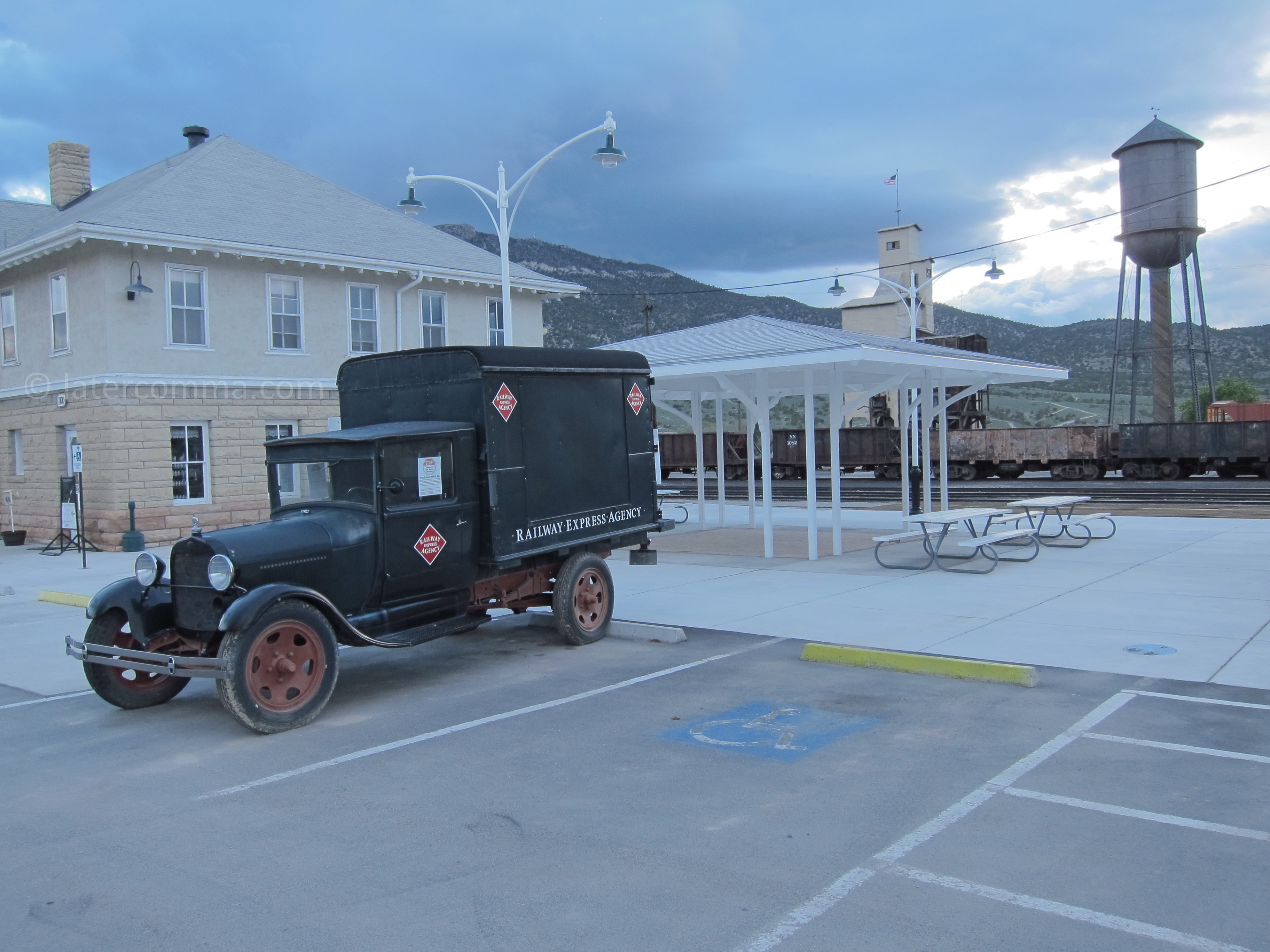
Nevada Northern Rail Yard in Ely
We visit the Nevada Northern rail yard in Ely, but the museum is closed. There are train rides you can take here, but unable to get tickets in advance, we dropped the extra day in Ely from our itinerary. We spend a comfortable night at the Bristlecone Motel, and in the morning we continue driving eastward.
Entering Utah on US 50
The countryside changes when we cross into Utah. We pass by Sevier Lake, a salty, 127,000-acre lake that is dry most of the year but today appears filled with water. We stay on US 50 until it joins with I-70 at Salina. The landscape is mostly flat, with some agriculture, until we reach I-70, which is an AAA-designated scenic route.
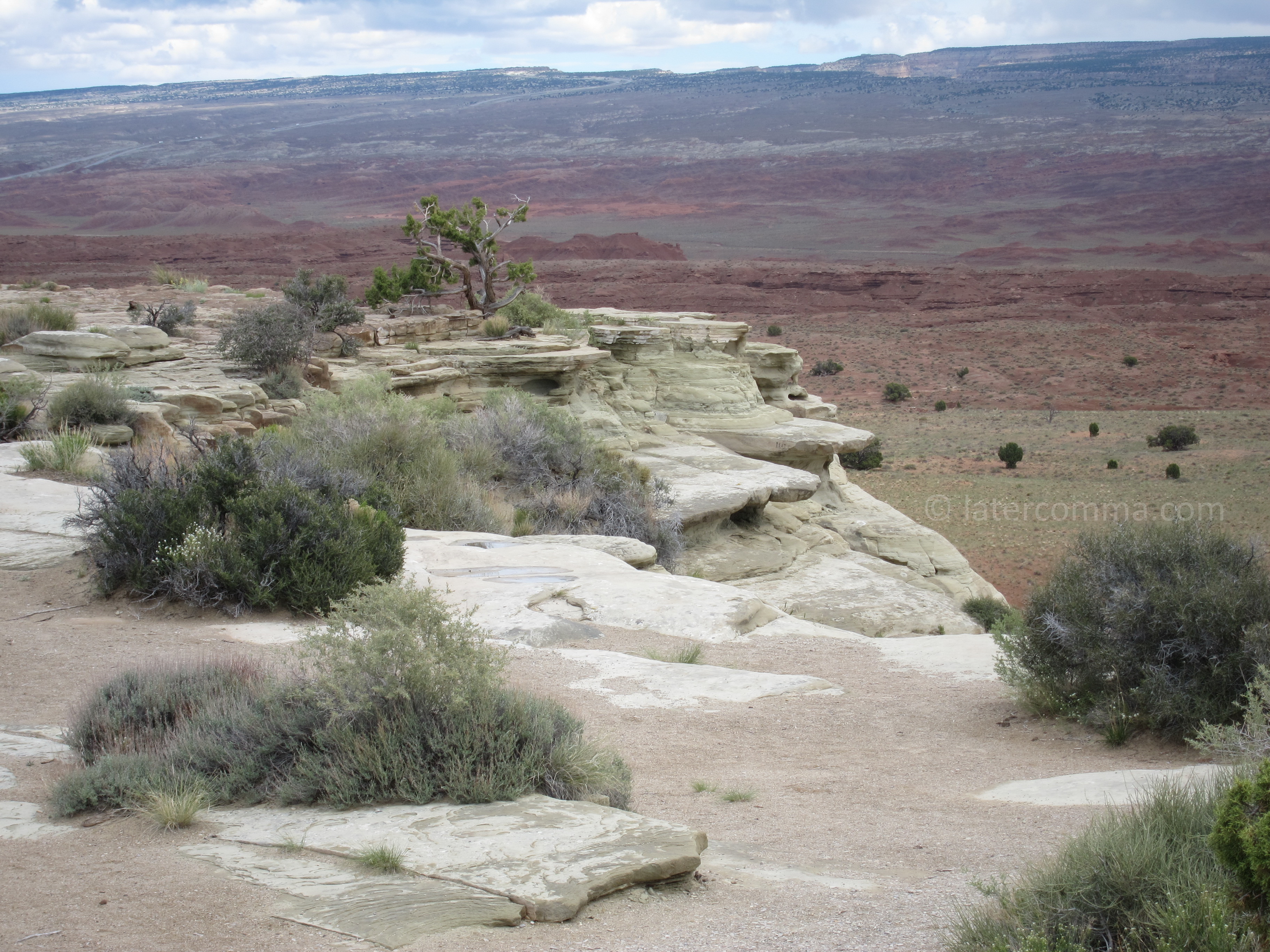
Utah On I-80 At San Rafael Reef
The designation is well-deserved as we soon find ourselves passing through awesome, deep canyons of red and yellow rock. We stop at most of the scenic overlooks—and we would stop again if we ever return here: It is that inspiringly beautiful. The area is called the San Rafael Reef. It is the most spectacular 50 miles we have traveled so far. The highway winds around through steep cliffs and then flattens out for the last 10 or so miles before we get to Green River, our destination for today.
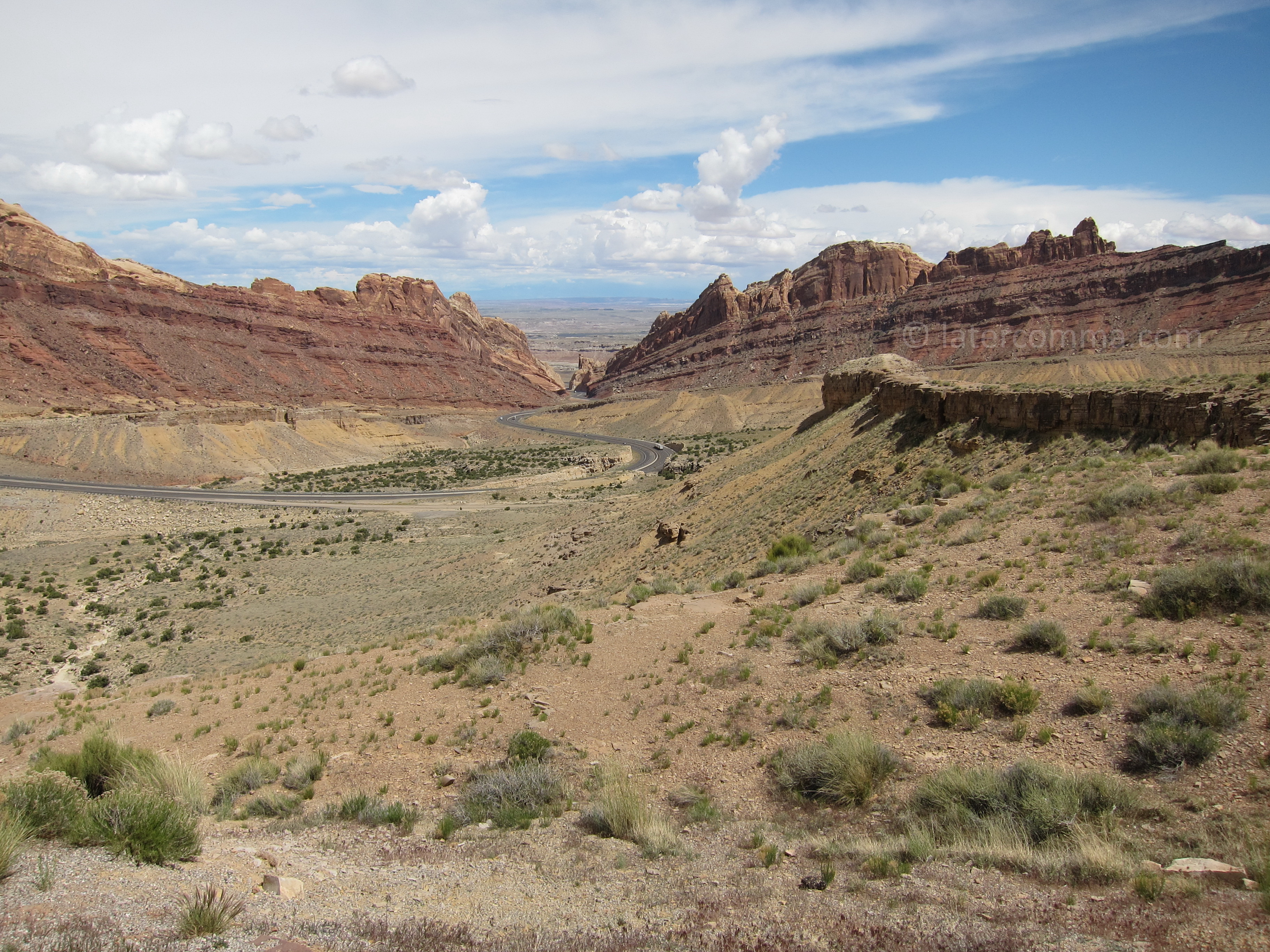
Utah On I-80 At San Rafael Reef
We get to the town of Green River about four o’clock and have time to visit the John Wesley Powell River History Museum. It is a small museum on the east bank of the town’s namesake river with exhibits about early river exploration and navigation. A short movie tells us the story of Powell’s expedition down Green River to the confluence with the Colorado River in 1869. Powell had served in the Union Army and had lost his right arm at the Battle of Shiloh. Later he became a professor of geology at Illinois Wesleyan University and director of the U.S. Geological Survey.
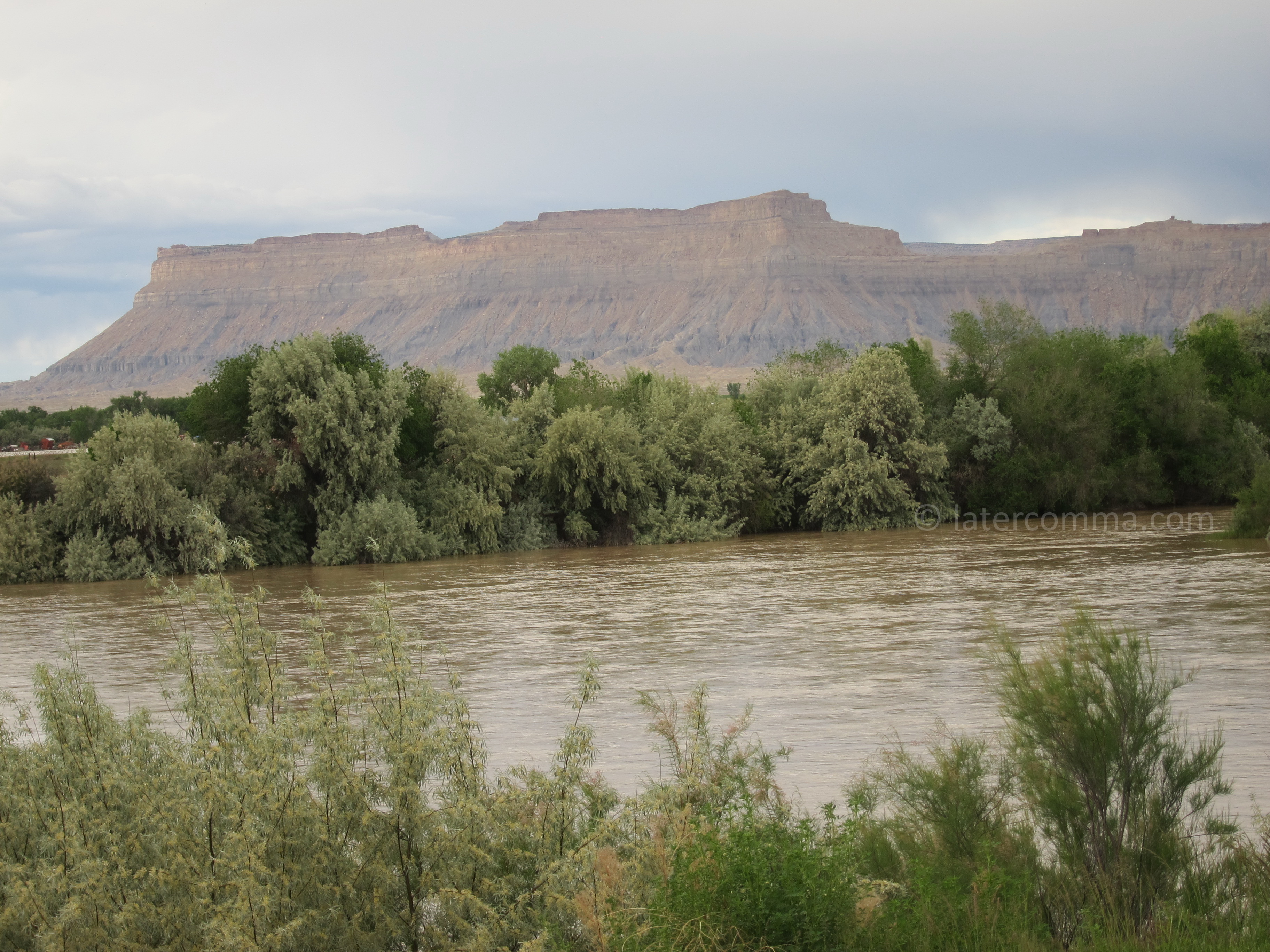
Green River
On this third day of our Wild West Road Trip, we have passed the 1,000-mile mark. We check into the River Terrace motel and celebrate with dinner at Ray’s Tavern where I have an excellent steak and my wife selects an excellent hamburger. Tomorrow we will begin our second 1,000 miles with a visit to Arches National Park.
More Wild West
Visits: 404
Some other stuff for later,
- 72
 We drive north from Buffalo on I-90. Our destination tonight is the town of Anaconda, about 20 miles west of Butte, Montana. The founder, copper king Marcus Daly, wanted to call the town “Copperopolis,” but another Montana mining town had already claimed the name. So the town became Anaconda instead,…
 - 71
 Leaving Durango, our road trip’s next destination is Buffalo, Wyoming. Our visit to Buffalo completes a circle, linking this road trip to our last big road trip when we visited the town for the first time and stayed at the Occidental Hotel in 2010. The distance from Durango to Buffalo…
 - 64
 We check in at the Durango Lodge for two nights. The motel’s pool is tempting, but dinner is our priority. We take a walk down Durango’s Main Avenue. The centerpiece is a grand old hotel, The Strater, built in 1887. Somewhat less pretentious is the General Palmer Hotel, built in…
Comments of Late