We would spend the next four days visiting three National Parks—Arches, Canyonlands and Mesa Verde—while advancing our road trip by 283 miles. Leaving Green River, we drive beside red cliffs that rise up from the rolling hills as we approach Arches from the north on US 191 and descend into a canyon. We reach the entrance to Arches National Park around nine in the morning. There is already a line of cars waiting to get in. The park has almost 1,500,000 visitors each year.
At the Visitor Center, we see a short film explaining the geology of Arches—something about subterranean salt domes, sandstone and slow erosion from rainwater. We are reminded again of what we have already realized on this road trip: it would be useful to have a book that interprets the geology of the West.
We decide to begin our tour of the park with a hike to Delicate Arch. The trailhead is about 13 miles from the park entrance. We drive through an exposed rock landscape in a palette of red, yellow, gray and white hues. We see lots of wildflowers and ravens seemingly blacker than crows.
The mile-and-a-half hike to the arch is uphill (a 480 foot gain in elevation). A hundred or more visitors got here this morning before we did, and they are streaming down the slickrock hillside as we climb. Many of the visitors are foreigners, including a tour bus-full of visitors from Japan, but we hear snatches of speech that sounds like French, German and Danish. There are Muslim women wearing head scarves. A young Japanese woman with her child on her back is wearing a long white dress and carrying a frilly parasol. Some of the tourists are wearing sandals or flip-flops.
We reach the end of the trail and the dramatic arch that is iconic of the park stands before us. There are fifty or more people scrambling over the rock to look at the arch, some of them daring to edge down the steep rock face to walk under the arch. It is enough for us to gaze upon this natural wonder from a respectful distance.
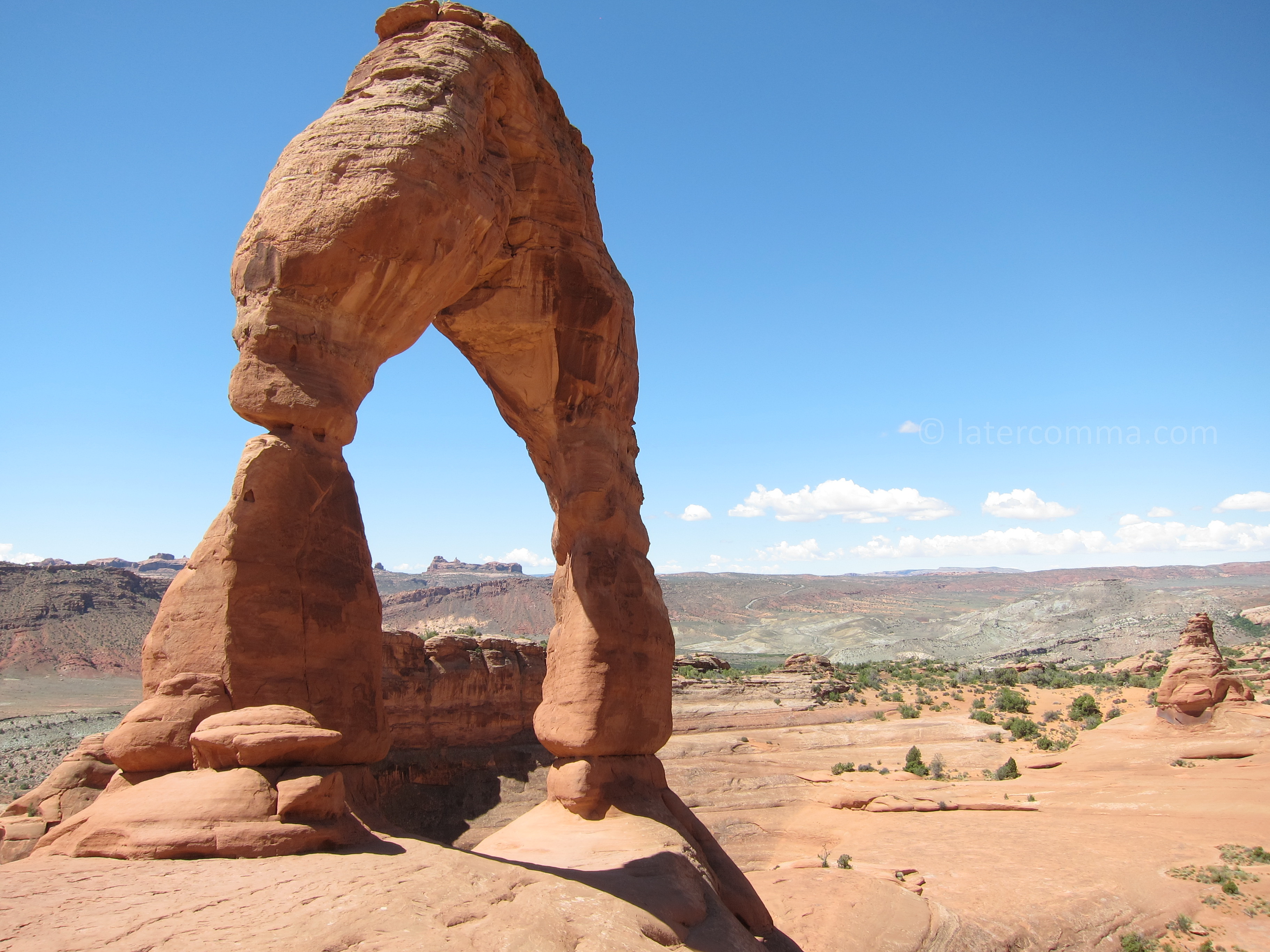
Delicate Arch
Our next stop is called Landscape Arch, located at the northern end of the 76,500-acre park. We eat lunch at the car before heading up the trail to the arch, a long delicate span (more than 300 feet), one of the longest natural arch formations in the world. In 1991, a 60-foot slab of rock fell off of the underside of the arch.
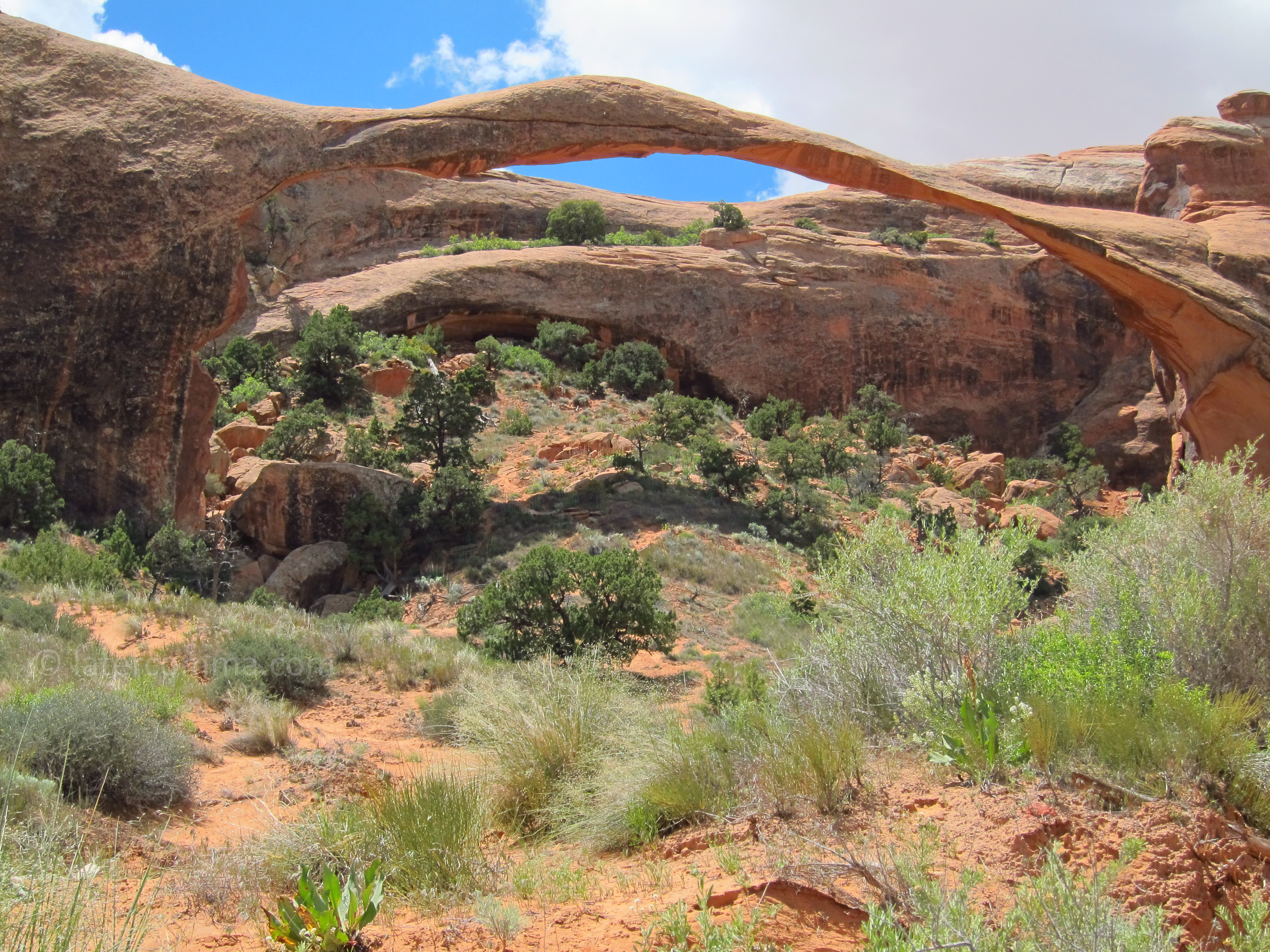
Landscape Arch
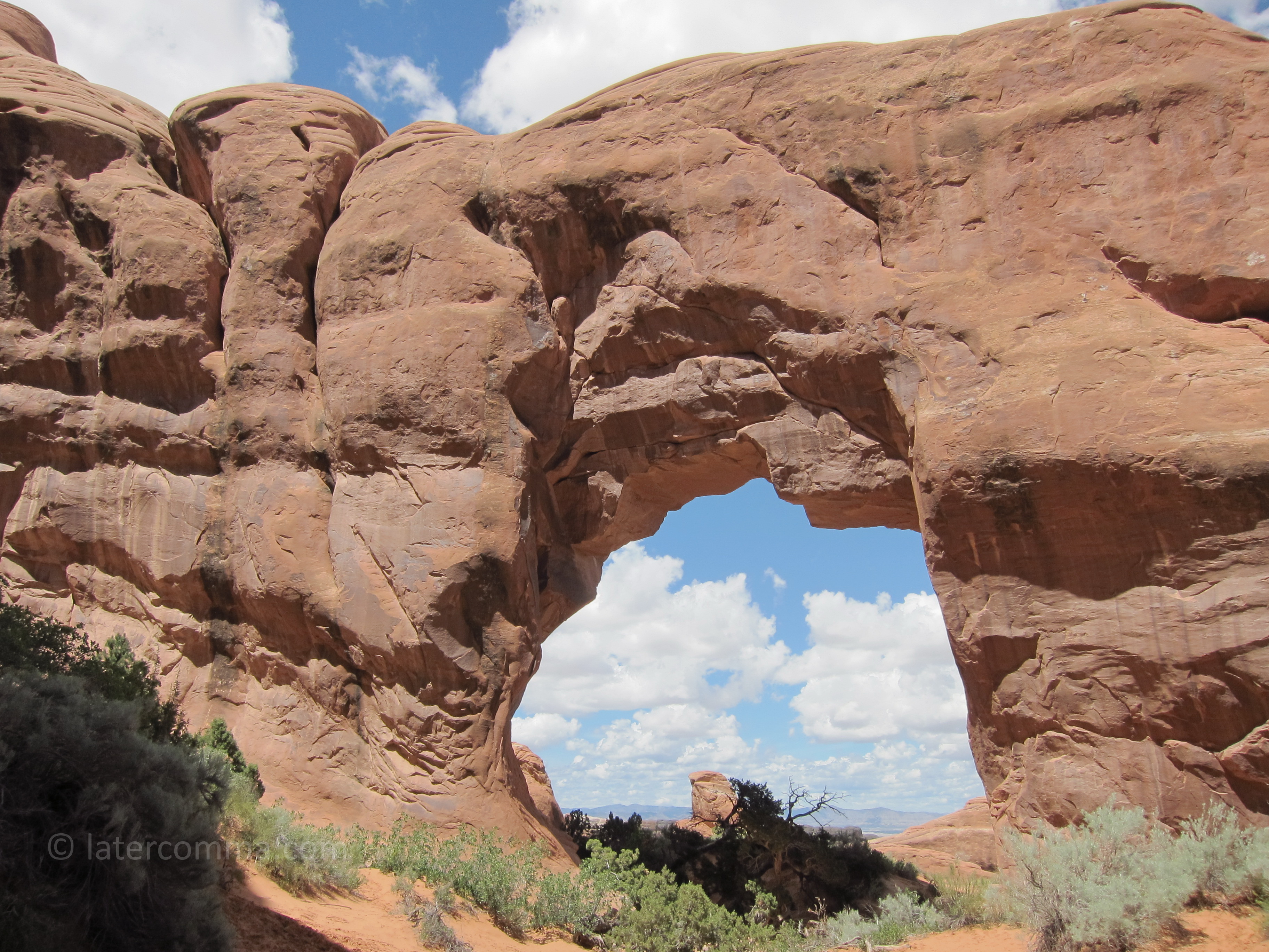
We drive back toward the park entrance to an area called “The Windows Section,” which will be our last stop in the park. We walk up the short trail to North Window, South Window and Turret Arch. We are remembering our last visit here, more than twenty-five years ago, with our daughter who was then seven.
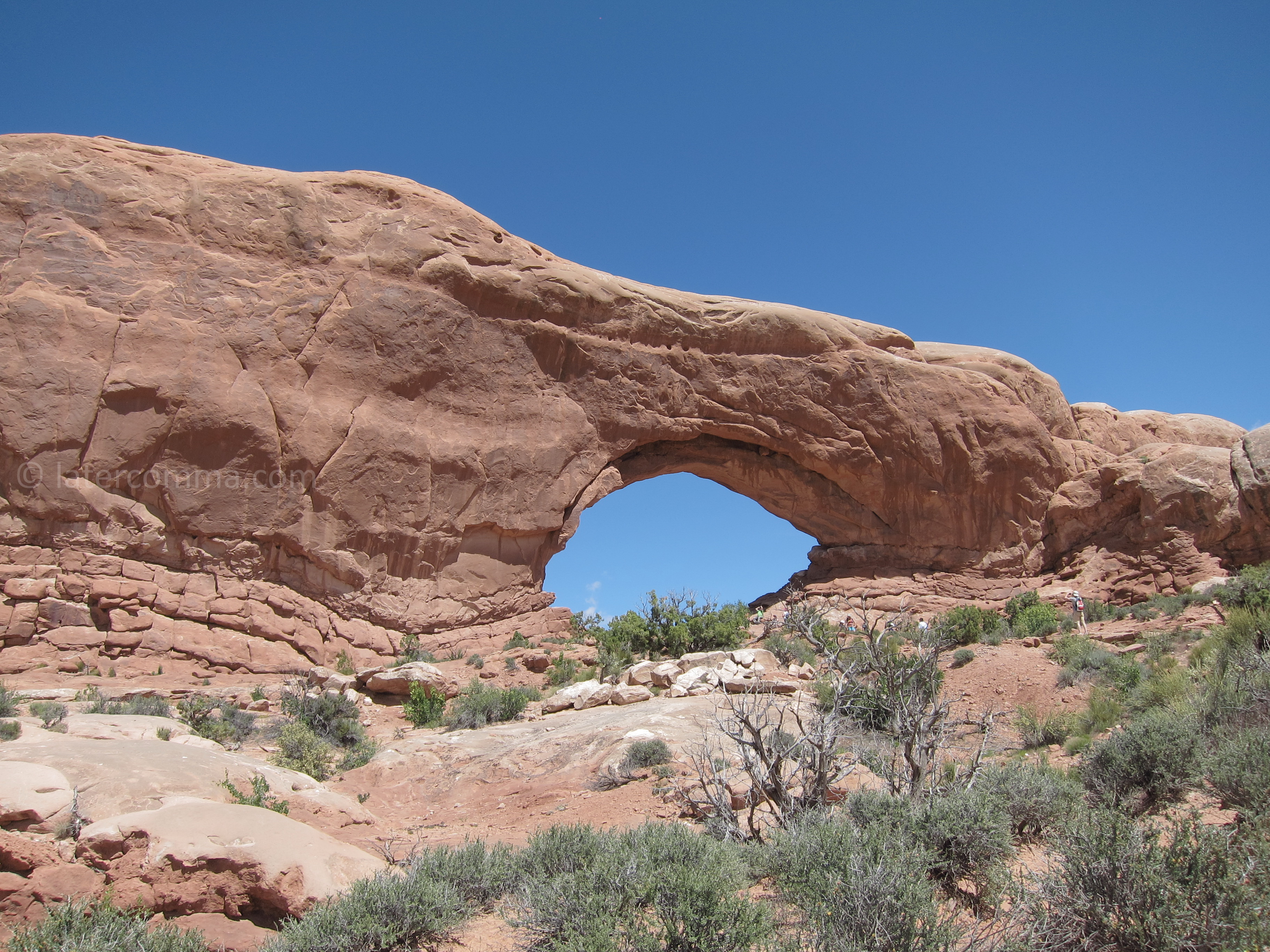
North Window Arch
We are tired, and we want to avoid park-tour overload. There are other viewpoints to see, other trails to walk, but sight-seeing to the point of exhaustion would defeat our purpose in being here. Enjoyment, it seems, sometimes depends on leaving something behind, something not done.
We stay the night at the Red Stone Inn in Moab. It is a very convenient motel with a small but comfortable room. We take showers to cool our sunburn and wash a couple loads of laundry in motel’s coin-operated laundry facility. We find dinner at Arches Thai. It is delicious, probably the best meal of our entire road trip and possibly the best Thai food we have ever eaten.
The next morning, we drive to the northern section of Canyonlands National Park. Canyonlands is a young park, established in 1964 under President Johnson. More than 634,000 people visited here last year. The northern section of the park is called “Island in the Sky.” The landscape is dramatic, and we stop to take pictures of “the Monitor” and “the Merrimac,” two rust-colored rocky buttes silhouetted against the morning sky.
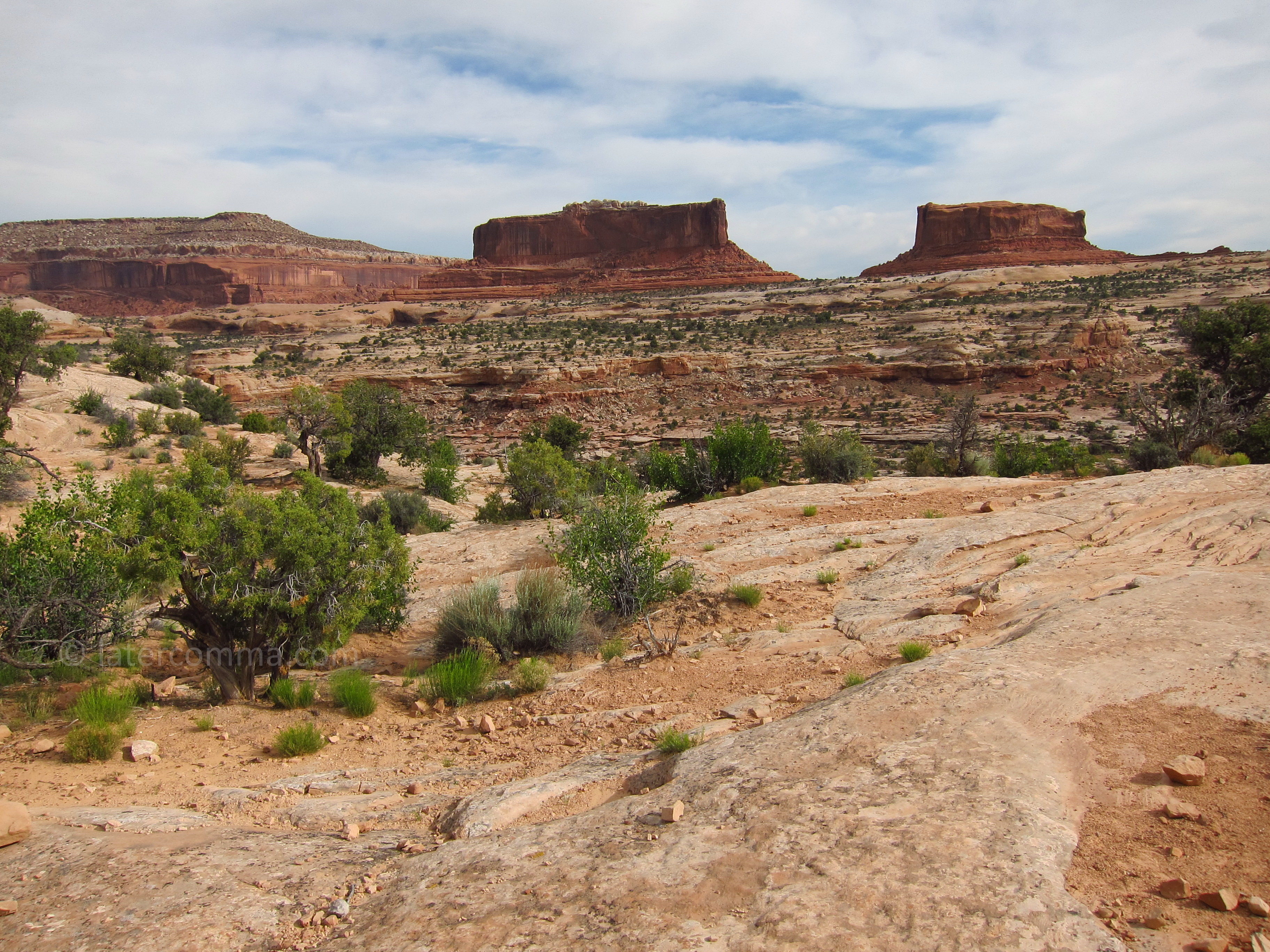
The Monitor and the Merrimac
At the Visitor Center, a Park Ranger assures us that we will have time to visit the southern section of the park as well. The drive to the southern section will take 2½ hours. We calculate that we will need to leave this Island in the Sky by 1:00 PM.
Our first viewpoint is Upheaval Dome. From the overlook, we see a deep circular canyon, about three miles in diameter with a pointed, uplifted peak in the center. Geologists are uncertain about how it was formed. Some believe that a meteorite struck here 60 million years ago and that rock heaved up from below to fill the unstable crater. Another theory is that the formation is the eroded remains of a “salt bubble” that emerged to the surface from salt layers below the surface over millions of years.
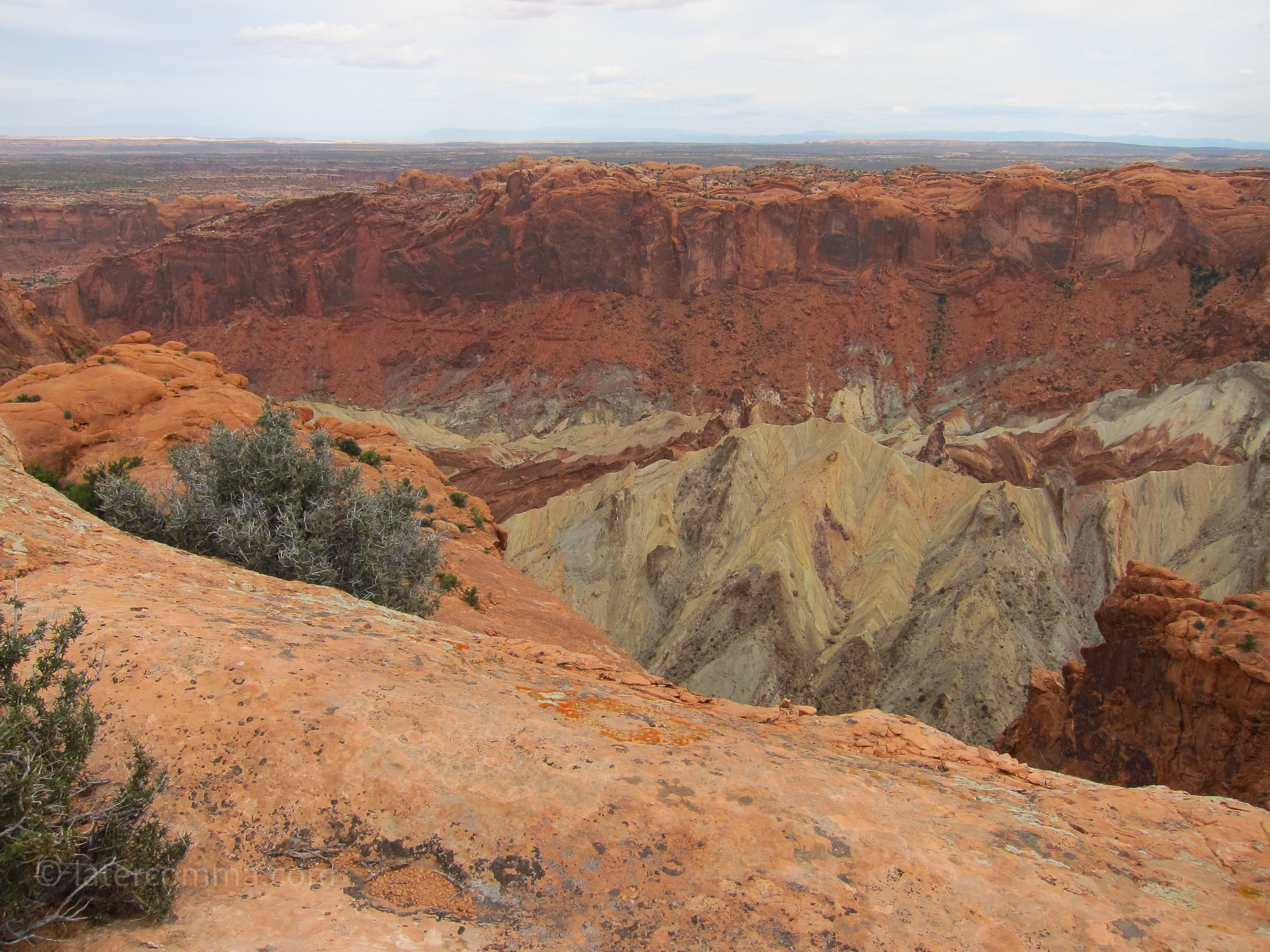
Upheaval Dome
We drive next to the Green River Overlook. An interpretive sign tells the story of John Wesley Powell’s expedition down the river in 1869—the same expedition that we had learned about two days earlier during our visit to the museum in the town of Green River. The point of confluence with the Colorado River, which Powell had reached during that expedition, is now within the boundaries of Canyonlands National Park. Looking south from the viewpoint, we see the Green River cutting through a deeply-eroded canyon and receding into the distance.
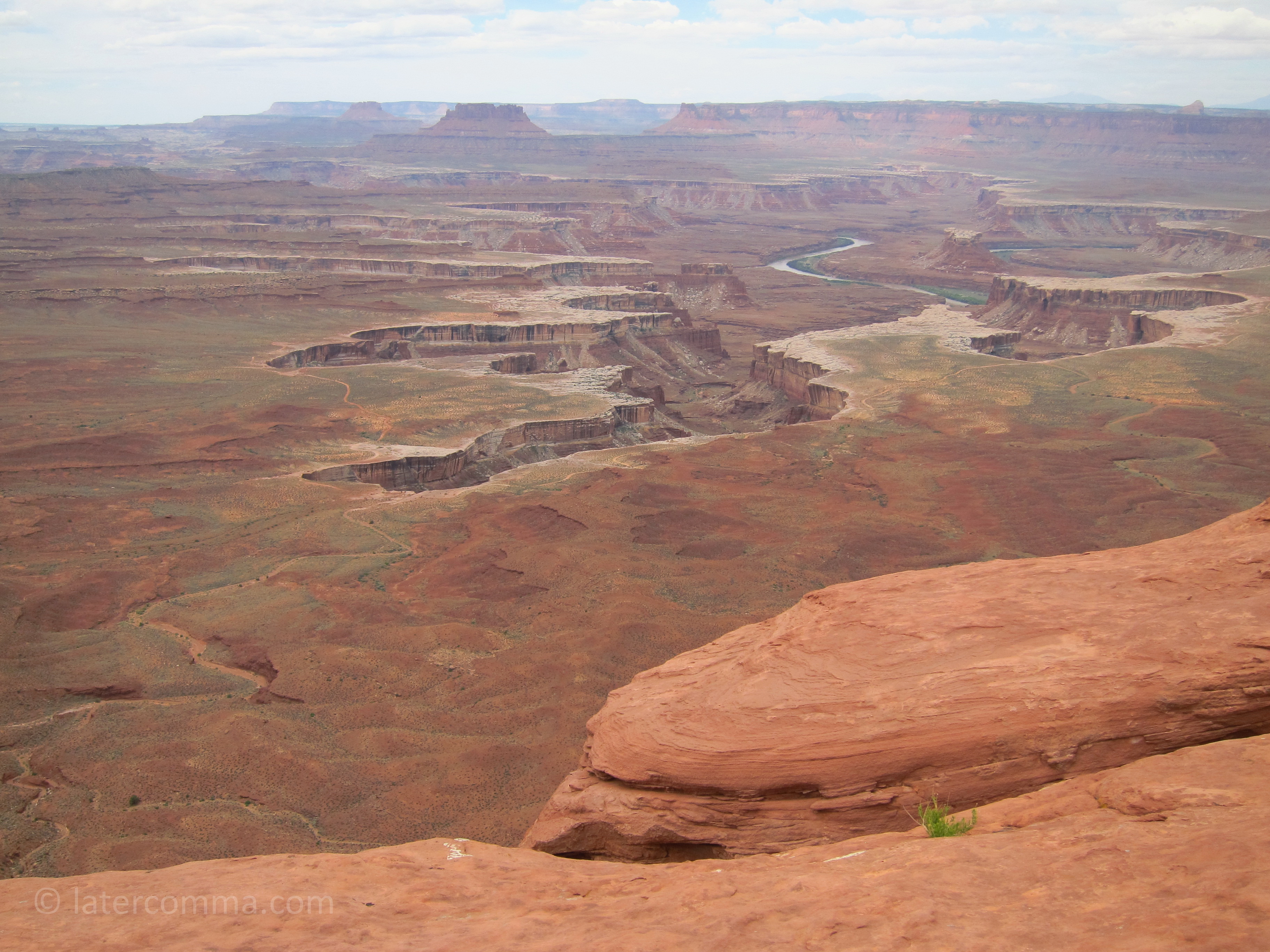
Green River Overlook
At the Grand View Point Overlook, we take a 2-mile round-trip hike along the canyon rim. The view is spectacular. The trail is mostly flat and there are lots of wildflowers. We scramble over rocks along some parts of the trail and, at the farthest end of the trail, we climb to the top of huge boulders. It is breath-taking.
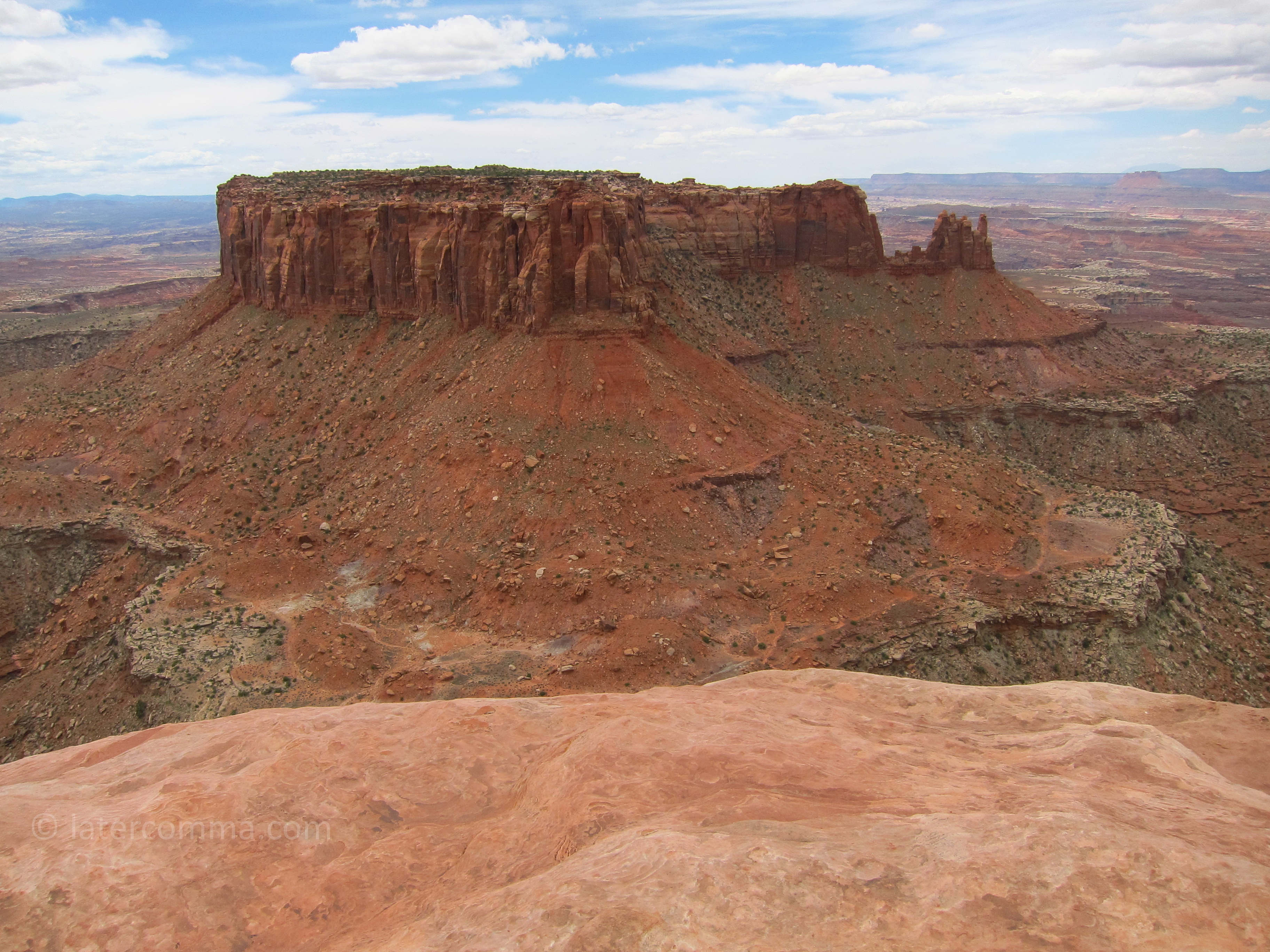
Grand View Point Overlook
On the way back toward the park entrance, we stop at Mesa Arch. It is an easy walk, rewarded by the view through the arch toward the La Sal Mountains.
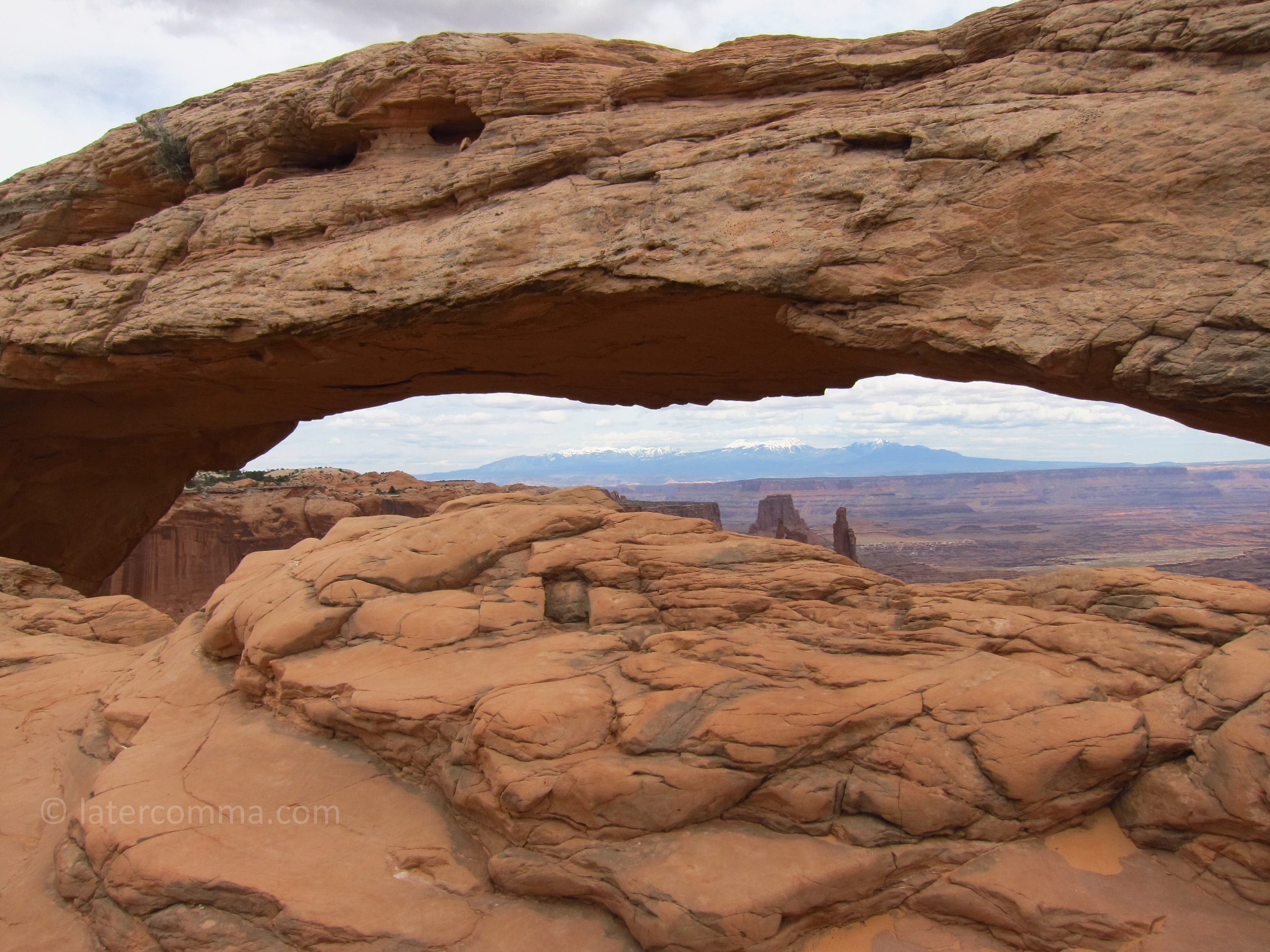
Mesa Arch
We drive back through Moab and find the cut-off for Highway 211 and the southern section of Canyonlands, which is called “The Needles.” It is more remote here, and there are fewer visitors. We stop briefly at the Wooden Shoe Arch Overlook then drive on to Big Spring Canyon. There is a trailhead here that leads to the Confluence Overlook, where the Colorado and Green Rivers join. It is a 10-mile round trip hike, and we are not up to it, but we climb a little ways down from the parking area over flat, sand-colored rocks to peer down into the canyon below.
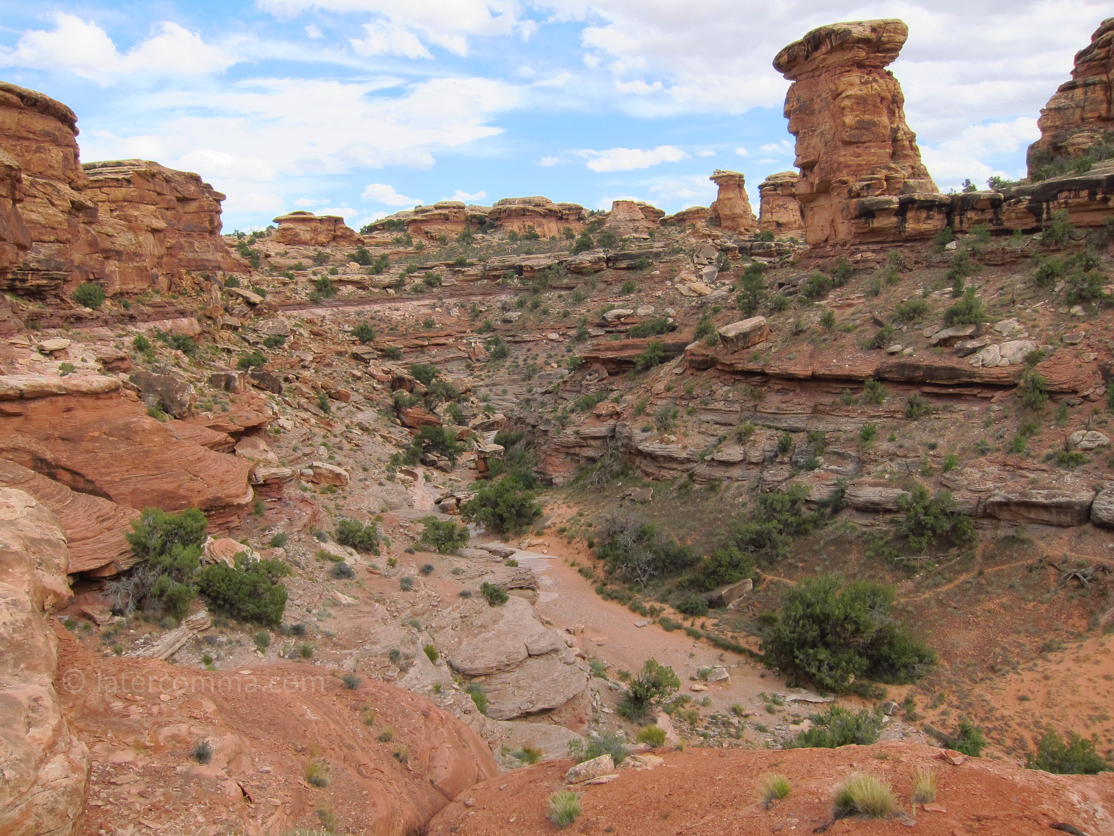
Big Spring Canyon
On our way back toward the park entrance, we stop for another short walk in an area called Pothole Point. In the distance we see a line of rock pinnacles—the “needles” that give this southern section of Canyonlands its name.
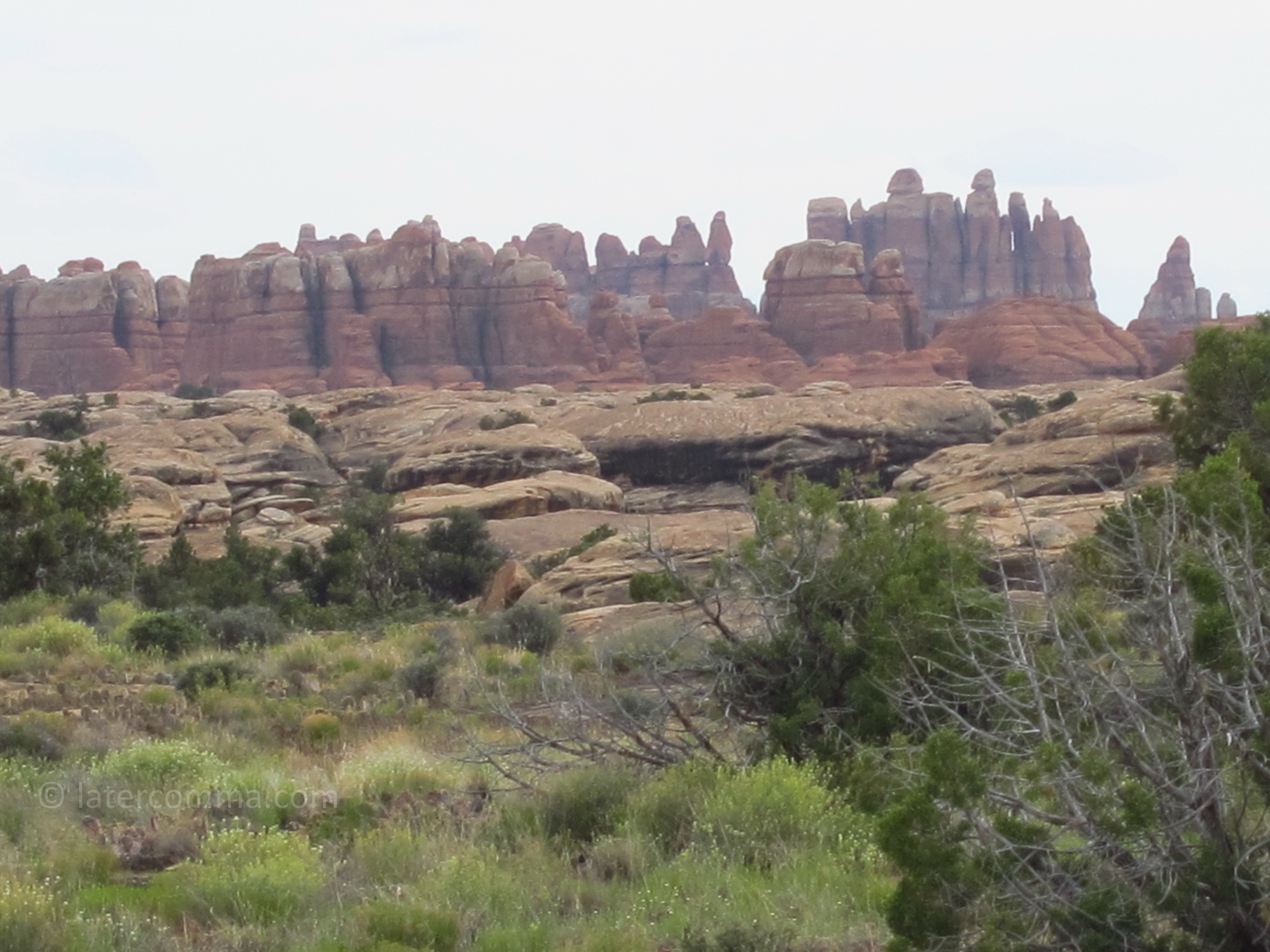
The Needles
Canyonlands National Park is filled with awe-inspiring scenery. It is so beautiful that you run out of superlatives to describe it. It is so vast and its geological history so ancient that it makes you feel insignificant. What did the settlers think when they first saw this country? How did people live here?
After leaving the park, we stop along Highway 211 at Newspaper Rock, where there is a large rock panel of petroglyphs. It is a State Historic Monument. Some of the carvings are believed to be 2,000 years old.
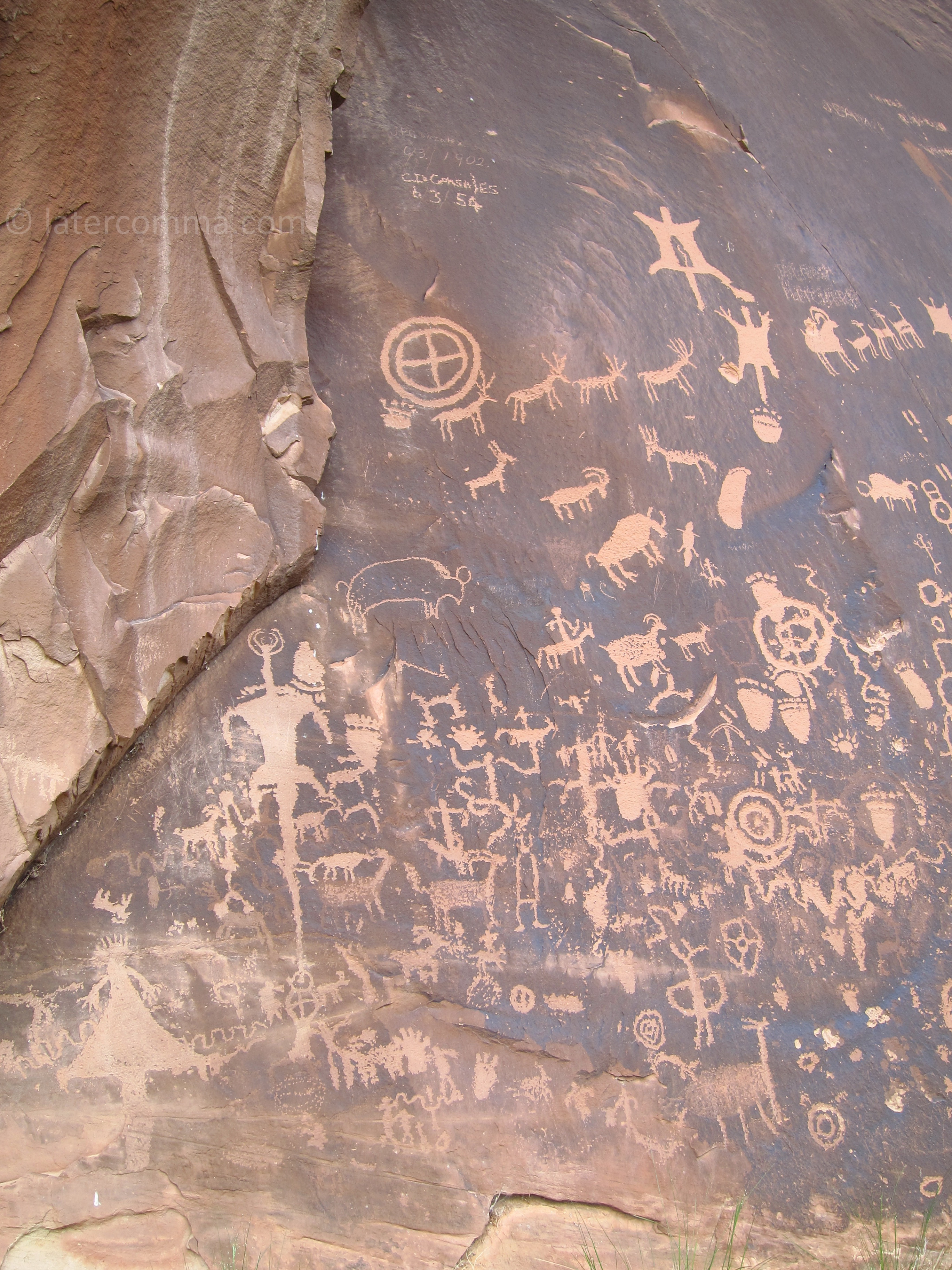
Newspaper Rock
We take Hart’s Draw Road over a mountain pass, and drop down into the town of Monticello, our day’s destination. Along the road, there are beautiful groves of aspen and an abundance of deer. We are staying at the Grist Mill Inn, a B&B built housed in remodeled flour mill. Our room key is waiting for us at a small table by the front door.
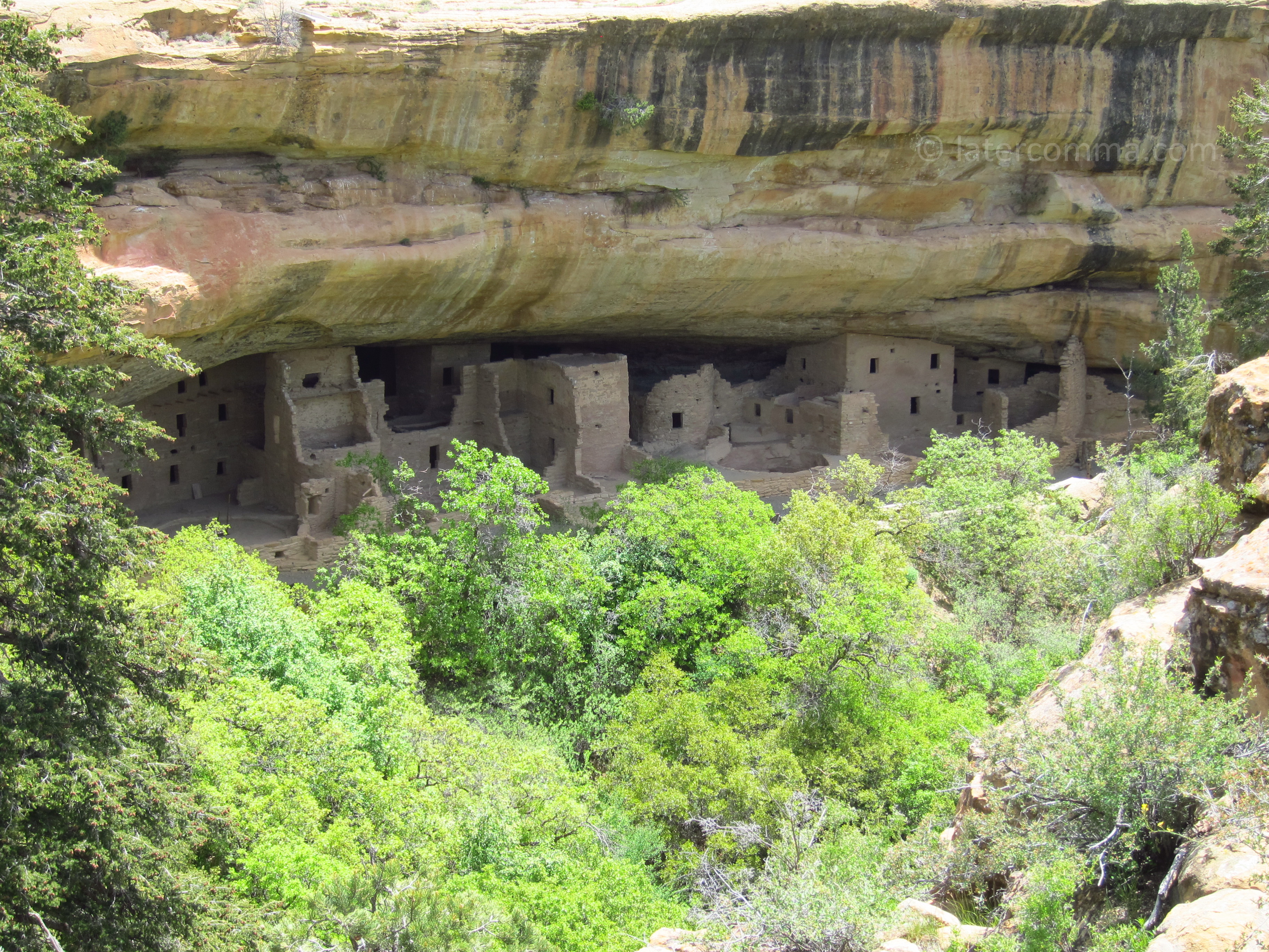
In the morning, we head east on US 491 and soon cross into Colorado. Mesa Verde National Park is about 90 miles away from Monticello and we arrive at the Visitor Center well before noon. The park was established on June 29, 1906, by President Theodore Roosevelt. There are more than 4,700 known archaeological sites in the park, including 600 cliff dwellings. Half a million people visit the park each year.
We buy tickets for two guided tours of the cliff dwellings. Our first tour—of Balcony House on Chapin Mesa—is scheduled for 3:30. In the meantime, we visit the museum. Spruce House is visible down a short trail by the museum, but touring the dwelling itself has been closed due to recent rock falls.
Spruce House
We take the Mesa Top Loop Drive and stop frequently at pull-offs to visit excavated pit-houses and canyon overlooks with distant views of cliff-dwellings. Although there are many other visitors, parking is never a problem.
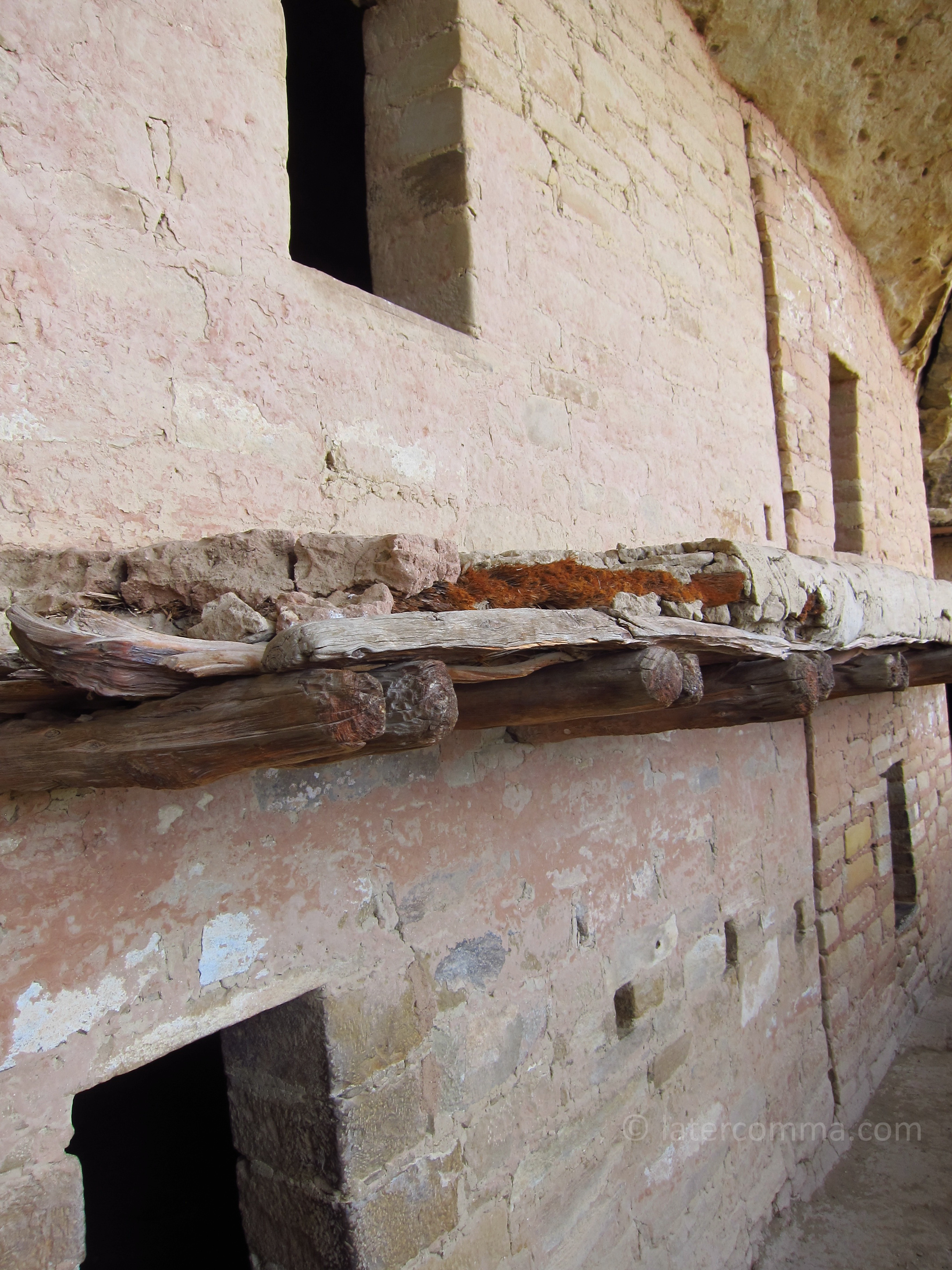
People lived in the Mesa Verde area for more than 700 years until the late 1200s. Between A.D. 550 and 750, the first Ancestral Puebloans, the Basketmakers, lived in pit houses clustered in small villages on the mesa tops. Beginning around the year 750, people were building structures aboveground with walls formed from poles and mud. Stone masonry appeared around the year 1000. The cliff-dwellings date from about 1200 and were occupied for less than 100 years. These dwellings were constructed from sandstone blocks mortared with mud. Most of the rooms were small—six by eight feet—and many were used for storing crops. Underground kivas were built in front of the dwellings, with their roofs forming courtyards. People migrated away from Mesa Verde, leaving the area deserted by 1300. The descendants of the Mesa Verde Puebloans are now among the tribes living in Arizona and New Mexico.
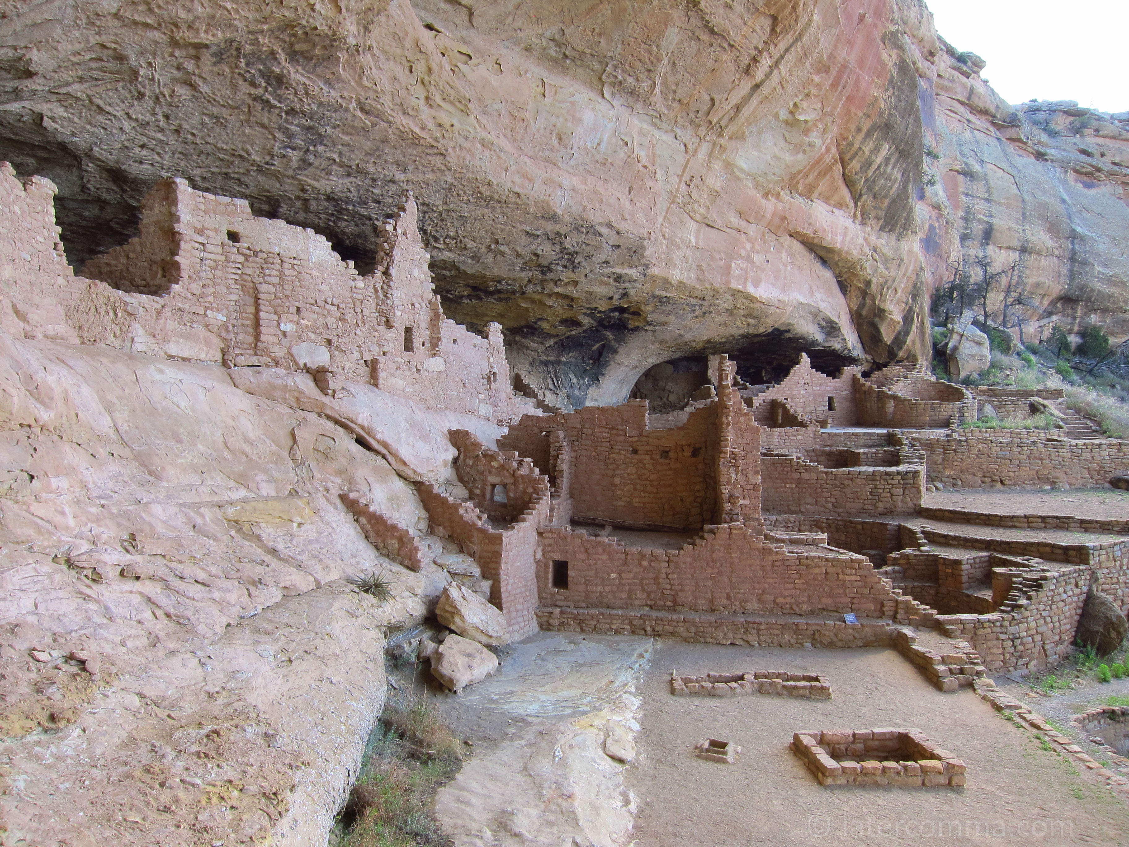
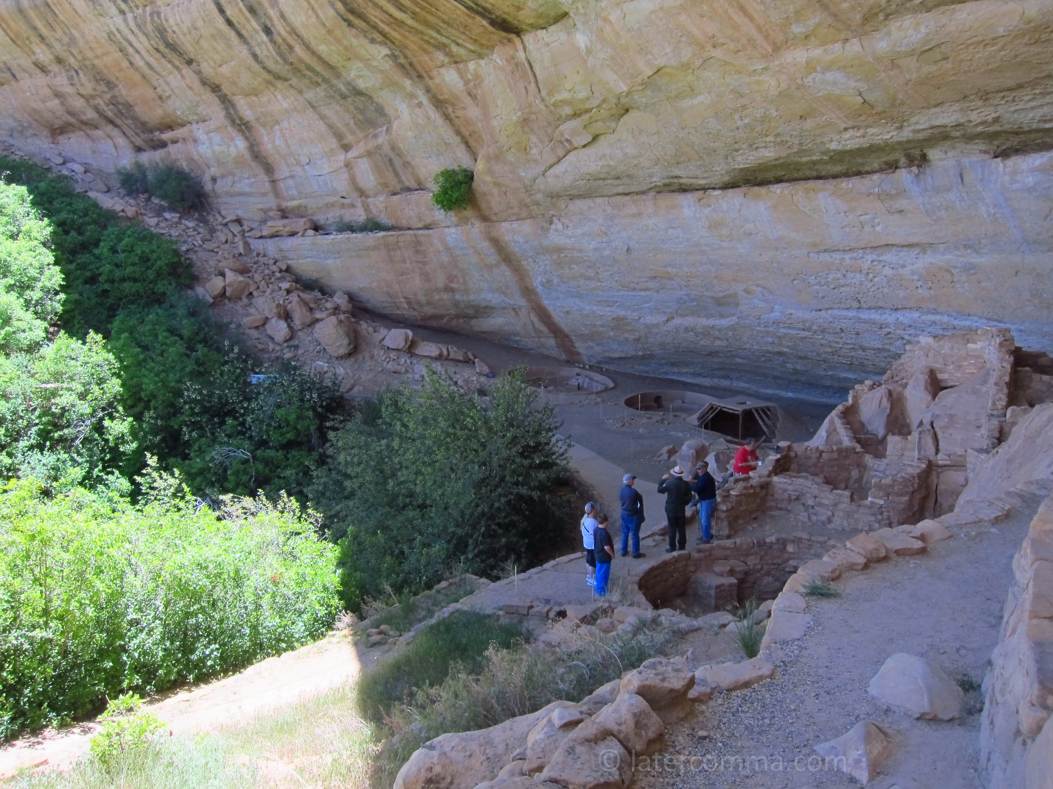
Our tour of Balcony House begins with a climb down a 30-foot ladder. It is difficult to imagine how people built their dwellings of stone and mud in such inaccessible alcoves. Just hauling in the rock, block-by-block, must have been an arduous endeavor. The masonry—which has lasted here for more than 700 years—is impressive. There are straight and square corners, formed without steel tools. What was it like to live here, on the cliff face, where one wrong step could send you tumbling hundreds of feet likely to your death?
Balcony House
After leaving Balcony House, we make our way back up the park road to the Far View Lodge, where we check in for the night. Our room has a picture window and a small deck looking out on the vast landscape of Mesa Verde. We had dinner at the Metate Room, Far View’s formal restaurant. I order a glass of a Cabernet, which improves my mood, but overall the dinner is disappointing.
Morning At Far View Lodge
In the morning, we check out around 8:00 and drive to the end of the Wetherill Mesa Road, about 12 miles, to be on time for our tour of Long House. The weather is perfect, a cool morning with sunshine and little wind. The start of the tour is an easy hike of just over a mile. A steep stairway leads to a short, paved path down to the cliff dwelling, a large collection of rooms surrounding a small spring. There are signs of rock paintings. A large ceremonial kiva occupies the wide courtyard area in front of the rock structures.
Long House
Two hours later, we are ready for some lunch, which we eat at a handy picnic table. While my wife enjoys some down time, I take self-guided tour of Step House. The Ranger who led the Long House tour happens to be at Step House, and I catch some of the narration he is giving to other visitors.
Step House
It is 27 miles back to the Mesa Verde Visitor Center and US 160. We take note of the sparse vegetation through much of the park. Between 1989 and 2003, more than half of the park’s 52,000 acres was consumed by fire, and it takes a long time to recover.
We make frequent stops, taking in the viewpoints that we had skipped on the way in. We have been to Mesa Verde twice in our lives, and we wonder whether we will ever visit here again.
We exit from the park and head east to Durango. It is only an hour’s drive.
More Wild West
Views: 0
Some other stuff for later,
- 67
 We drive north from Buffalo on I-90. Our destination tonight is the town of Anaconda, about 20 miles west of Butte, Montana. The founder, copper king Marcus Daly, wanted to call the town “Copperopolis,” but another Montana mining town had already claimed the name. So the town became Anaconda instead,…
 - 65
 My wife and I recently returned from a trip that included a two-night stay in Savannah, Georgia. Neither of us had been there before, yet some source deep in memory gave me the notion that we would find a charming, picturesque and historic place. In preparation for our visit to…
 - 63
 On a sunny Monday morning in the middle of May, we set out from our home in Oregon’s Willamette Valley. As we would do on most mornings during our road trip through the American West, we had flipped a coin to decide who would take the first driving stint. Each…
Comments of Late